A Wiltshire walk - Strawberry Hill, West Lavington
 |
| From the bottom of Strawberry Hill, to the Wessex Ridgeway that leads to Imber |
You can park behind Dauntsey's school, just off the B3098 to Westbury. Directions are for walking the route clockwise, but I've no preference and tend to alternate our walks. OS Explorer 130 is the map you need if you're the cautious sort.
Walk away from the road, and at the end of Dauntsey's car park turn left to follow the field boundary with a new mixed hedge on your left - always plenty of bird life here. At the end of the playing fields bear 45 degrees left across to a kissing gate in the hedge.
 |
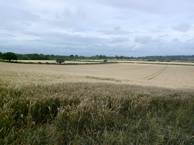
| There's a kissing gate in the clump of trees centre: the strip lynchets are to their right |
Continue through this towards the modern barn in front of you: the footpath goes to the left, between the barn and the hedge. Some fine views up to the strip lynchets, ancient terraces now thought to have been caused by years of ploughing. Because turning a plough was difficult fields were kept long and narrow - an acre was the area a man was expected to plough in a day, defined as 220 yards by 22 yards. Is it a coincidence that a cricket pitch is 22 yards long?
Join the Tarmaced lane, and turn right. There are some fine grand houses on one side, and All Saints church is worth a detour. Otherwise carry straight on, onto the track in front of you as the lane turns sharp left.

Carry on to a crossroads at the woods known as The Warren. Again a detour to explore them is a worthwhile excuse for a picnic, but if you carry on it will almost double the length of the walk, and add a very steep incline to get back down to a Bridleway that is poorly marked on the ground although clearly shown on an OS map. So turn right, and start to climb up a chalk path with hedges either side. Soon you will cross a Tarmaced lane, but to the left it is private property. So climb up the track to the top of Strawberry Hill.
From the top you can see the old plague pit, in the side of the hill above All Saints' church. In the distance is Oliver's Castle, the site of the battle of Roundway Down.
 |
| Oliver's Castle is on the left of the Downs in the distance |


Comments
Post a Comment